As the UK’s long-term environmental monitoring and research (LTER) programme, ECN has been collecting detailed environmental information from a range of terrestrial sites over the past 20 years. Work at these sites has great potential for groundtruthing Earth Observation (EO) data collected by satellites, aircraft and Unmanned Aerial Vehicles (UAVs, drones).
Meanwhile, monitoring at ECN sites should benefit from recent advances in satellite image resolution. A range of exploratory studies are helping to elucidate links between reflectance signals and a range of ecosystem properties and processes. These studies could also benefit the development of tools for conservation management.
This work complements an objective of the European Long-Term Ecosystem Research community to strengthen operational links between remote sensing and the European LTER infrastructure. Work on this was carried out during the eLTER H2020 project.
ECN site measurements to support Earth Observation
| Site abbreviation | HIL | NOR | POR | ROT | WYT | ALI | CAI | GLE | SOU | MOO | SNO |
| Main habitat type(s): | |||||||||||
| - Lowland grassland/agricultural | ● | ● | ● | ● | ● | ||||||
| - Wooded | ● | ● | ● | ● | |||||||
| - Upland moor/pasture | ● | ● | ● | ● | ● | ||||||
| ECN site since... | 1992 | 1992 | 1994 | 1992 | 1992 | 1992 | 1999 | 1992 | 1992 | 1992 | 1995 |
| Meteorology data (hourly resolution) | ● | ● | ● | ● | ● | ● | ● | ● | ● | ● | ● |
| Soil data | ● | ● | ● | ● | ● | ● | ● | ● | ● | ● | ● |
| Vegetation plot data | ● | ● | ● | ● | ● | ● | ● | ● | ● | ● | ● |
| Land Cover Map data | ● | ● | ● | ● | ● | ● | ● | ● | ● | ● | ● |
| Land cover and land use records | ● | ● | ● | ● | ● | ● | ● | ● | ● | ● | ● |
| Fixed point photos1 | ● | ● | ● | ● | ● | ● | |||||
|
Aerial photos from 1994 |
● | ● | ● | ● | ● | ||||||
| Aerial photos from 1994 and additional years | ● | ● | ● | ● | ● | ● | |||||
| Phenocam images | ● | ● | ● | ||||||||
| UAV images and/or data2 | ● | ||||||||||
| COSMOS-UK soil moisture measurements | ● | ● | ● | ● | ● | ● | ● | ● | ● | ||
| FPAR3 | ● | ||||||||||
| Hyperspectral data | ● | ||||||||||
| Lidar4 | ● |
Notes
1 See our fixed point photos page
2 From UKCEH operated UAV. Potential to overfly other sites, subject to funding
3 FPAR: Fraction of Photosynthetically Active Radiation
4 Lidar: Light Detection and Ranging
There are also ECN data available for Drayton, a lowland agricultural site in the English Midlands, from 1993-2014.
Examples of relevant work
Wytham Wood
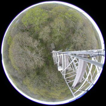
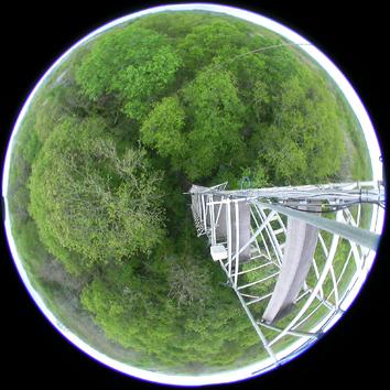
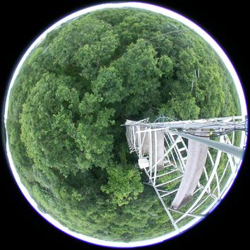
Wytham is a mainly wooded site near Oxford. NPL have deployed FPAR (Fraction of Photosynthetically Active Radiation) instruments to calibrate & validate MODIS satellite output. UKCEH are monitoring phenology using COSMOS (Cosmic Ray Soil Moisture Monitoring Network) phenocams & ECN fixed-point photos, spectroradiometer and satellite data, and a University of Oxford study has assessed great tit breeding success in relation to oak leaf phenology and peak caterpillar abundance. Wytham has also been the focus of a University of Cambridge study using airborne lidar (Light Detection and Ranging) and hyperspectral data to estimate aboveground biomass, to map species and to analyse leaf chemistry. Meanwhile, UCL and the University of Salford have used Wytham as a test site for ground-based lidar.
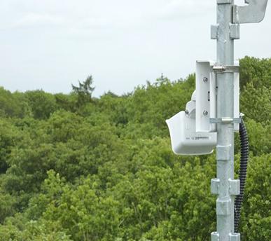
▲Camera mounted on the flux tower at Wytham
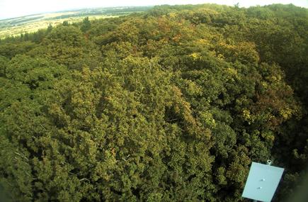
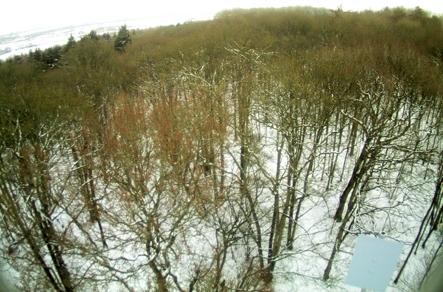
▲Winter and Summer images of the tree canopy from the flux tower camera
Alice Holt
Alice Holt is a research forest in Hampshire. Forest Research have installed 180° field of view ‘fish eye’ cameras mounted on a flux tower, two viewing the canopy and one facing upwards. Digital images captured every 30 minutes from these cameras over a two year period were analysed and compared with eddy covariance measurements of CO2, H2O and energy fluxes. The RGB ‘Hue’ parameter was found to correlate closely with actual photosynthetic rate, demonstrating the potential of very simple imagery to inform on changes in this fundamental ecosystem function.
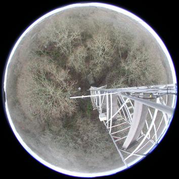
▲Four fish eye images of the Alice Holt tree canopy from the flux tower, taken at different times of the year, show leaf emergence [Images ©Forest Research]. Dates are: 18 January, 6 May, 10 May, 7 July 2016.
Moor House
Moor House is a moorland site in the North Pennines. UKCEH have been collecting daily images of dominant vegetation types since 2010 from fixed cameras. Digital image analysis used to infer variation in greenness and flowering patterns is now being complemented by NDVI (Normalised Difference Vegetation Index) sensors. Separately, images from a series of drone flights during 2015 were used to characterise the spatial distribution of broad habitats at sub-metre resolution. This approach should assist land managers in assessing the changing ecological quality of their sites.
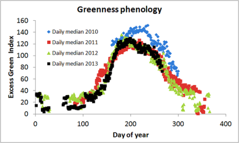
▲Seasonal change in greenness of a Moor House meadow plot determined from digital images [Image ©UKCEH]
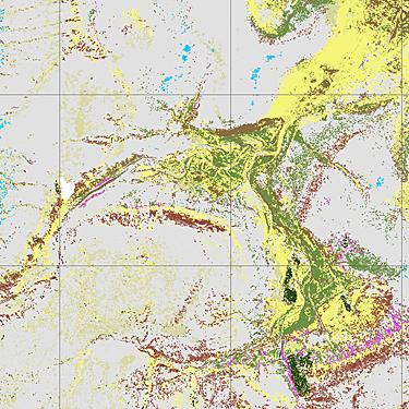
▲Moor House habitat map derived from sub-metre resolution drone imagery [Image ©UKCEH]