What is a Cold Front?

A cold front occurs at the leading edge of  a cold air mass that is moving to replace a warmer air mass.

Diagram showing a cold front

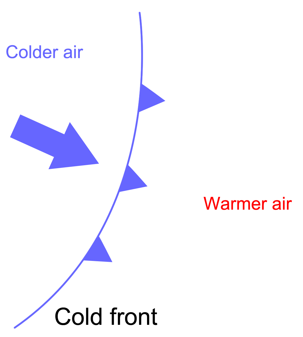
Diagram showing a cold air front. The cold air mass is moving to replace the warmer air mass and at the boundary a cold front forms.

These different air masses do not mix because they have different temperatures and densities.  As the cold front develops the warm air ahead of the front is pushed up over the top of the cold air.  This happens because the warm air is lighter (less dense) than the cold air.  You often see clouds forming at a cold front.   This is because as the warm air rises, it cools and moisture in the air condenses.  Clouds are masses of cool, condensed air.

Fronts can be several hundred kilometres in width. The air behind a cold front is cooler than the air in front of it.  If a cold front passed overhead when you were standing outside, then you would feel the air cooling down. The air would also be dryer than before.

The weather maps below will help you understand how to recognise a cold front.

Excercise

The chart below shows a cold front over the UK on the 24th December 1997.  Although it is old, it shows a cold front clearly. The front is the black line with the triangular lumps on it.  It travels in the direction of the wind - in this case west to east.  You can see that the weather conditions ahead of and behind the front are different.

We said before that the air temperatures ahead of the cold front are usually warmer than the temperature behind the cold front.  We can see the difference on this map.

British Isles weather chart 24 December 1997. Daily Telegraph

[Source: Daily Telegraph]

Symbols on the map

  • Thin black lines: These are isobars. They link areas with equal air pressure. the values are pressures in millibars, with inches in brackets
  • Arrows: Direction of the wind (wind speed is shown in miles per hour)
  • Numbers in black circles: Air temperature in degree Celsius (degree Fahrenheit is shown in brackets)
  • Icons: Show main weather features such as light cloud, rain, sunshine, etc.
  • Thick lines: Fronts, either cold (marked with triangles), warm (semi-circles) or occluded (both marks)

Questions

  1. What is the change in air temperature ahead of and behind the cold front?
  2. What other weather conditions change ahead of and behind the front?
  3. Write down the main differences between a warm and a cold weather front.